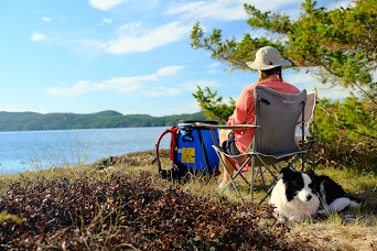
Canoeing for 8 days / 111km around Broughton Archipelago Marine Provincial Park in British Columbia with my wife, Claire (7.5 months pregnant) and our dog, Zoa
Click here to read about the planning of this trip.
Over the past few years I've become more and more drawn to the ocean. I used to be kind of put off - it's deep, dark and full of weird creatures big enough to swallow you whole. But I'm growing to really enjoy the unique challenges and opportunities that ocean trips provide.
Opportunities like camping on tiny islands, watching humpback whales swim past in the glow of the sunset.
Challenges like navigating on a compass bearing through thick fog while accounting for currents and using a marine radio to communicate with nearby boats to ensure they're aware of our presence.
I learned a lot on this trip, which was super rewarding, but by far the best part was watching Claire be a total bad-ass at 7 and a half months pregnant. We moved camp (130kg at the start) every day except for one rest day, and we still got out and paddled in the rain on that day. It was a tough trip, mentally and physically - I can't put into words how strong that woman is!Click here for a full GPX of our route. I'll also reference the BC Marine Trails website a bunch. And here's the Gaia map I used to plan and navigate.
Night 1 - Finding somewhere to sleep
After work on Friday we caught the ferry from Horseshoe Bay to Nanaimo and drove as far as we could (almost to Campbell River) before I was too tired. We found a forest service road to pull over and sleep. Claire didn't like the spot I chose so we slept in the car instead of the tent. Good job because the next morning a passing security guard told us there were a lot of bears around.
Day 1 - Telegraph Cove to Crease Island - 16km
We parked in Telegraph Cove and paid the $10 put-in fee and the $5 per day parking fee, then lugged our 130kg food, water and equipment down the dock to put-in at low tide which was awkward and slippery.
Accessing Broughton Archipelago Marine Provincial Park was probably the hardest part of the trip because it involves 2 large crossings (each about 2.5km) across channels which are notorious for strong currents, thick fog and heavy cruise ship/tanker traffic.

Straight out of Telegraph Cove, we hit a thick wall of fog. I first made a call to Victoria Traffic on channel 71 to make sure there were no approaching large vessels in Johnstone Strait, then it was time for the first of many compass bearings. I was planning to go around the east end of Hanson Island and use the currents to push us through Blackney Passage, but I totally failed to account for the currents in Johnstone Strait and by the time we were across, we were nowhere near where I had planned. 2.5km is a lot of time for the current to push you off course. So, we went round the west end of Hanson through Weynton Passage.
Once around Hanson Island, we had another large crossing across Blackfish Sound - famous for whale watching. In fact, this area has the highest concentration of orcas in the world (we saw many humpbacks, but no orcas). I made another call on channel 16 to boats in the area to alert people of a solo canoe crossing with limited visibility, and again when we were safely across. So far, so good... and the fog had cleared up!
After a lunch stop on Flower Island we continued on to a really nice camp site with tent platforms and a pit toilet on Crease Island ("Rough Islets" on the BCMT site). We spent
the night with a group of 4 kayakers from Squamish - funnily enough I had met 2 of them the winter before on a ski touring trip to Wendy Thomson Hut.
Day 2 - Crease Island to Maud Island - 15km
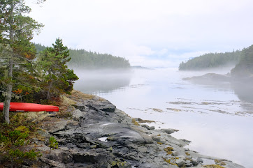
Another foggy morning meant we could sleep in and get a lazy start - on the water around 11:30am. On canoe trips, I'm used to moving early to avoid strong winds that build in the afternoon - but that didn't seem to be an issue in our forecast and the mornings were so foggy it made sense to wait until that fog burned off.
We backtracked a bit to to Blackfish Sound to watch porpoises playing and humpbacks breaching for a while, then headed east towards Village Island to see an abandoned First Nation settlement. I was also hoping to find a fresh water source but had no luck, and right after jumping back into the canoe we spotted a black bear digging through the beach right where I was stood just minutes before.
The plan was to stay on Pearl Island but as we paddled past there was no sign of a camp or an obvious place to land. There were a lot of downed trees which may have been blocking the landing site... not sure if this camp is still feasible. So we continued on and I'm so glad we did.
We found a tiny rocky island with a single tree off the northern shore of Maud Island ("Indian Group" on BCMT). At high tide, these are three tiny islands which then become connected at low tide. Little did we know we were in for a spectacular sunset as a humpback whale swam past our island. I grabbed the drone and was so lucky to get bird's-eye footage of the humpback breaching (after spending 5 minutes filming a patch of kelp that I thought was the whale, wondering why it wasn't moving).
Day 3 - Maud Island to Fox Group - 14km
We were able to get weather forecasts via the InReach and radio on the weather channels. We knew bad weather was coming the next day so we planned to take a rest day in the Fox Group and avoid the rain. This camp is in the forest so we figured we could set up a tarp and hunker down for a few nights.
The paddle to the Fox Group started with another couple of foggy compass bearing crossings - this time the currents were kind to us, but we had an exhilarating experience when a humpback popped up right behind us, where we'd just been 2 minutes before.
We weaved our way through tiny islands and lagoons until we got to a small First Nation village marked on my map as "Health Bay/Gilford Sound Seaplane Base". It was here that I hear a "ding-ding" sound coming from the front of the canoe, and Claire saying random words in Italian. Turns out she had found cell reception and instead of getting vital information - like an updated forecast - she's continuing her 200 day Duolingo streak. I still don't understand how she found enough cell reception every day to keep her streak going!
We pulled up to Fox Group South mid-afternoon and luckily managed to snag the very last tent pad. This camp has been developed in the spring of 2023 to have 2 cook shelters, a pit toilet and around 15 tent pads. A guided group was taking most of the tent pads, and the others were occupied by smaller kayak groups and a couple of guys on paddle boards who had come from Telegraph Cove that morning (30+km)!
We knew a lot of rain was coming over the next 36 hours so I set up the tarp to give us somewhere to sit outside the tent, and (hopefully) collect some rain water to boost our water reserves. The downside is that the rain is amplified by the tarp so the next 2 nights were quite noisy!
Day 4 - Rest day at Fox Group - 6km
We had a very lazy morning, not getting out the tent until 11am before enjoying breakfast under the tarp. My rainwater collection had worked, but the water had an orange tint to it from the tarp. I made a few questionable cups of coffee with the water and used it to wash up, but not much else.
When the rain eased up in the afternoon we went for a short paddle around the Fox Group islands, spotting more porpoises, seals, loons and bald eagles. The rain didn't hold off for long and we were soon racing back to camp to escape the downpour.
We spent that evening with some of the others from camp, playing cards, telling stories of past adventures, and nerding out over current charts and weather reports. While I love being totally alone with Claire and Zoa on some tiny island somewhere, it's also a great contrast to meet interesting new people and hear about their experiences.
Day 5 - Fox Group to Booker Lagoon - 18km
While planning this trip I had found a spot on the BCMT website which looked really appealing. It's an almost closed off lagoon on Broughton Island which is inaccessible at certain times of day due to the 8 knot currents which develop in the tiny entrance channel. I figured this would be a good goal, and also the furthest north we have ever paddled.
The weather was overcast and gloomy, but the fog and rain held off. We had a long paddle north, checking out a few other campsites along the way before we turned west to head around the northern end of Eden Island. Here we found quite a few fresh water sources (maybe due to the recent rain) before a 2km channel crossing against the current and into a headwind.
As we approached Booker Lagoon it seemed like the low tide would block our entry, but the entrance was obscured round a corner and the currents helped to push us in the right direction. We paddled across to a small island on the far north shore (where we found more fresh water). It's the eastern island directly north of the lagoon entrance, as described on BCMT.
The island has a few flat spots for tents, and there's evidence of old fire pits and, weirdly, a small pruned apple tree which we used as a drying rack. But the concerning part was the three large bear scats, two were fairly recent, and a LOT of fish skeletons and shellfish carcasses around. It felt like a very wild place, and something definitely lived on this island (maybe a marten or a weasel).
Claire felt uncomfortable initially at this camp site but we had no other options and as time went on, with no sight of any critters, we both started to feel at ease and appreciate the remoteness and the peaceful surroundings more akin to a small lake than the ocean.
Day 6 - Booker Lagoon to Start Island - 16km
The goal today was to head to the Sedge Islands, but as I read the description of the campsite we were both a bit put off by the words "gloomy, damp site". I figured we would get as close as we could and try to find something a little nicer.
We left Booker Lagoon as the tide was going out and the currents were with us, crossed back across to Eden Island, then began to meander and wiggle our way through dozens of tiny forested islands and narrow passages barely deep enough for our canoe to pass through. The weather had improved with patches of sun and blue sky.
As we paddled around Start Island, we spotted a couple of flat rocky outcrops that looked like promising camp spots. Access to these sites was tricky with the ocean swell, as we were now right on the open ocean with no islands or trees to protect us from the elements. This spot had a very epic feel to it but there was some concern about the exposure.
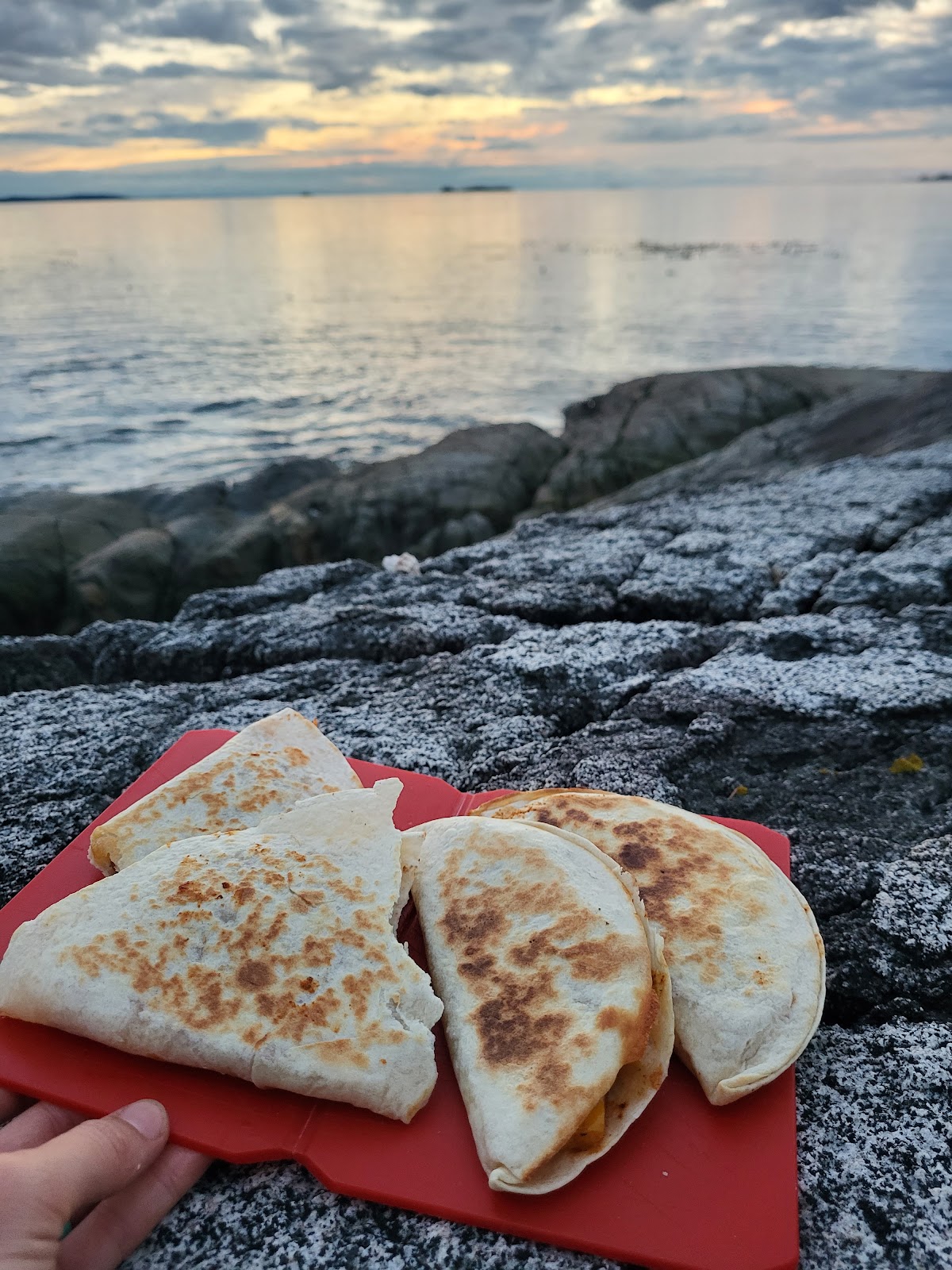
I checked the tide charts to figure out how much further the tide would rise, and got updated InReach weather forecasts to confirm that no wind was coming. I felt comfortable with our exposure based on the information we had. And what a place it was to camp, perched on a somewhat flat rock just a couple of metres from the ocean, watching the sun set over Queen Charlotte Strait as we ate quesadilla.
Day 7 - Start Island to Plumper Islands - 16km
Our forecast showed that some rain was coming today, so we decided to start early and make the most of the dry weather. The tide was low which made loading the canoe entertaining on the slimy rocks. Once again we had fog, but visibility was good enough to not need the compass.
We paddled south around Sedge Islands and agreed that we were glad we had camped on our rocky outcrop instead - despite the awkward access. From Sedge Islands we continued on to Owl Island where there's another BCMT campsite often used by guided groups. We figured we would check it out.
A couple were on the beach having a coffee and told us the camp had been raided the day before while they and another kayak group had been out on a day trip. At some point in the afternoon, a boat had come by and someone had stolen food, clothes, equipment, stoves, etc. from everyone at Owl Island North camp, only leaving the tents and alcohol untouched. Apparently they had carefully opened up dry bags, stolen belongings, then closed the dry bags back up as if untouched.
It's sad that even these beautiful and remote places are subject to targeted theft. Without food and equipment, a trip is over, or worse, you have to call for rescue.
With that sad news on our minds, and the rain starting, we continued on to Swanson Island West to shelter from the rain and have lunch, then crossed back across Blackfish Sound. The original plan was to camp in Leg Cove on Hanson Island, but I really wanted our last night to be out of the forest, with a view. I was a bit fed up with clearing wet pine needles off all the gear, and even longer to get them off the dog!
As we got closer to Plumper Island we spotted a flat rocky ledge on a small island that appeared to have an old fire pit. We pulled over to scout it out and it looked just big enough for our tent. Access was, once again, awkward but we made it work just in time to huddle into the tent as the rains returned. By this point we were all exhausted. Zoa climbed into the tent and fell asleep immediately and we snoozed through the rain.
As seemed to be the theme of the trip, every night was unique and special. The rain stopped and waves of fog washed around our tiny island as sealions barked and fought, bald eagles hunted and seals splashed around. It was a very atmospheric place with a lot of weird sounds. Day 8 - Plumper Islands to Telegraph Cove - 9km
Sometimes you just have to go #2 but there's not enough earth to dig a hole for the poo - this was my morning dilemma. Determined to "Leave No Trace", I resigned to "Pack it out" and not-so-accurately did my business in an empty dehydrated meal pack from the night before, triple bagged it, and slung it in the back of the canoe.
Surprise, surprise, it was foggy again for our final morning. We had to cross back across Johnstone Strait to Telegraph Cove but this time I knew to account for the currents. At the last rocky outcrop before the crossing, we found two kayakers in the fog. Their GPS had died and they were unsure how to navigate the crossing. We joined forces (safety in numbers, right?) and I made a call on channel 16 to alert nearby boats that three kayaks were crossing with very limited visibility. A tug boat replied saying he was 35 minutes out. We figured this was enough time for a mad dash across.
I took a compass bearing for a small island 2.5km away on the other side and 20 minutes later a small island appeared out of the fog right where it was supposed to be. Much better than on the way out! I called again to let the tug know we were out of the way, and we paddled the final stretch to Telegraph Cove, just in time for the fog to clear up, revealing a beautiful, cloudless, sunny sky.
8 days earlier we had spotted The Old Saltery Pub in Telegraph Cove, and we'd been talking for days about stopping for burgers when we got back, so we did! That was a perfect way to end the trip, looking out over Telegraph Cove with beautiful weather and a cold beer, reflecting on the journey and - as is always the case - pondering what the next one will be.Final thoughts
Claire is one tough cookie. I was tired by the end, and I'm not 7.5 months pregnant! I think what she found the hardest was sleeping in a tent (or car) for 8 nights and never getting a proper comfortable sleep. While I tried to do most of the heavy lifting, there were times where Claire had to do awkward carries of the canoe across seaweed covered rocks which was difficult at times. I continue to be impressed by her strength and resilience.
This trip combined so many skills and allowed me to learn and practice new ones - like using a marine radio. I don't think I would change much about what we did, or what we took. We had too much food - but that's not a bad thing. There wasn't enough sun to power the solar charger and recharge camera batteries - but that's out of our control. The biggest win was that Zoa didn't eat anything stupid...in comparison to a previous trip where she ingested an entire starfish!
Overall, I would say the trip exceeded all expectations and went as smoothly and on-plan as I could have hoped. Next time, there will be 4 of us in the canoe!😊


Comments
Post a Comment